
Pratomagno is the mountain range that separates Casentino from Valdarno, a green ridge stretching across woods, pastures, and panoramic ridges. It is one of the most fascinating natural areas in Tuscany, perfect for those seeking silence, clean air, and authentic landscapes, far from the beaten tourist track.
Here, nature expresses itself in all its beauty: wide meadows, beech and chestnut woods, trails suitable for all types of hikers, and panoramic viewpoints that embrace the Apennines, the Chianti hills, and, on clear days, even Monte Amiata.
The network of trails is well marked and offers numerous possibilities: you can climb from different sides, such as Loro Ciuffenna, Talla, or Reggello, or follow the main ridge with wide, panoramic stretches, also ideal for day trips.
At the summit stands the Croce del Pratomagno, a 20-meter-high iron structure that has become a symbol of this area. Reaching it on foot is one of the most popular experiences for visitors to the area: the route is accessible, surrounded by nature, and offers spectacular 360-degree views.
TRAIL 00
Trail 00 on the Pratomagno ridge goes from Passo della Crocina (664 meters above sea level) to Poggio Uomo di Sasso (1535 meters above sea level), passing through the peak known as Croce di Pratomagno, where it reaches its highest point (1591 meters above sea level).
Link: https://caivaldarnosuperiore.it/sentiero-c-a-i-n-00-crinale/
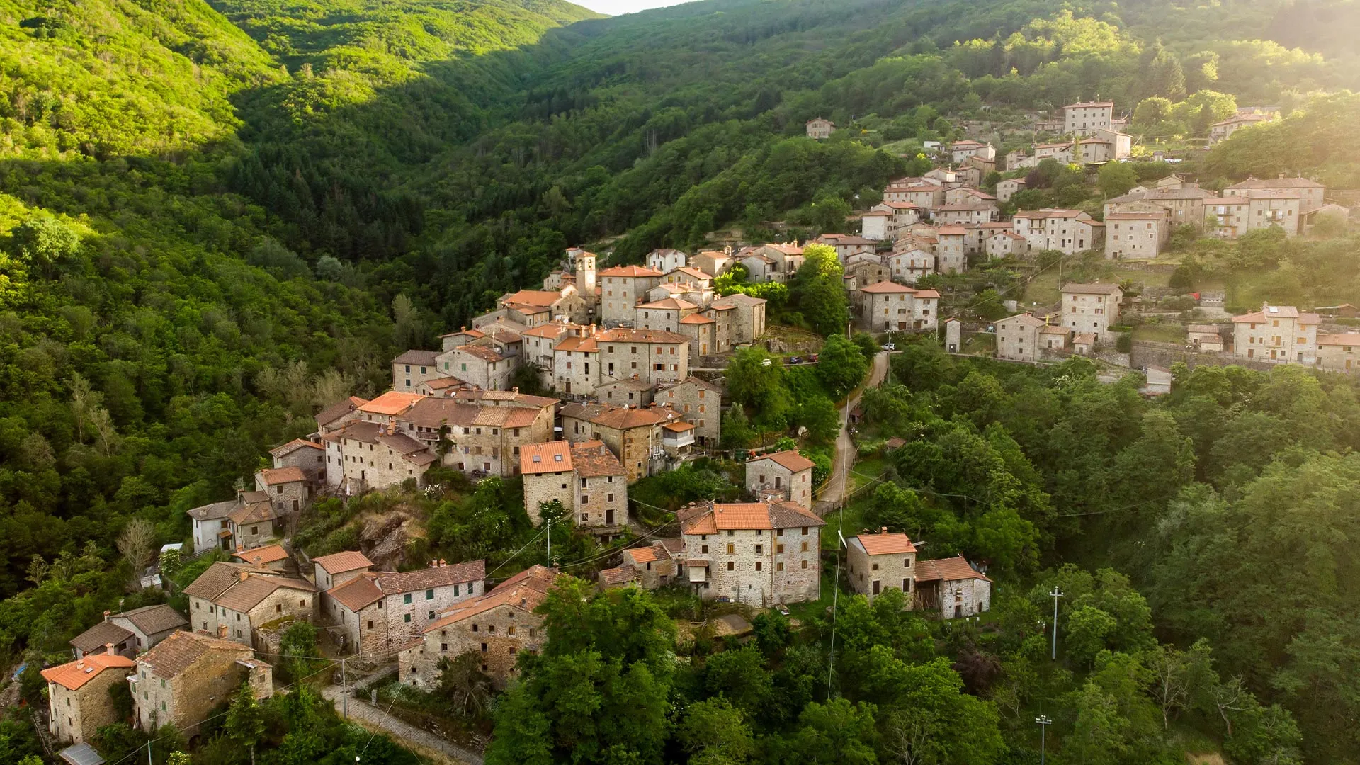
TRAIL 21
The C.A.I. Trail No. 21 is one of the most significant trails under the responsibility of the Valdarno Superiore Section. Starting from below La Trappola (La Casa, 748 m above sea level), it takes hikers to three of the most beautiful mountain villages. First San Clemente (548 m above sea level), then Poggio di Loro (630 m above sea level), a real gem of a mountain village, and then Rocca Ricciarda, with its thousand-year history (880 m above sea level). From Rocca, in one last leap, you reach the Croce di Pratomagno, the summit of our mountain (1591 m above sea level).
Link: https://caivaldarnosuperiore.it/sentiero-c-a-i-n-21/
TRAIL 41
Trail no. 41 starts from the last houses of San Giustino Valdarno (314 m above sea level) and, climbing steadily, arrives at Ca' di Vestro (560 m above sea level), continues across the Pratomagno panoramic road and connects to ridge trail no. 00 (789 m above sea level) at Fonte Archese.
